Sunday, June 26, 2016

C&O Day 4 - Marble Quarry to Union Station, Washington DC

And the great adventure is now complete. Max and I have ridden the Great Allegheny Passage and the C&O Canal Towpath from Pittsburgh to Washington DC.

Seven days, 350 miles. Three hotels (Pittsburgh, Cumberland, Williamsport) and four nights camping. We never cooked for ourselves while camping, although I was prepared to do so.

Our last day was short because of the long day Max ordered up for the day before. Furthermore, Max also decided that we not dawdle around in the morning. So we were on the bikes at 7:00 AM.

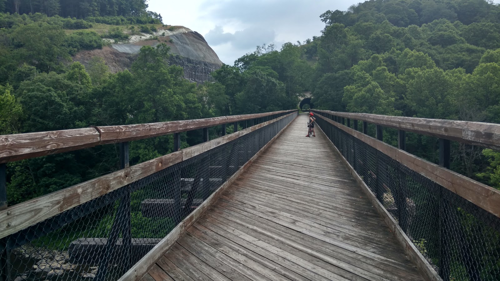
This made for a tough day for both of us. Max had a lot of aches and fatigue, but he kept his spirits up and we persevered.

The first bit of good news was the cafe at White's Ferry was open for business, and we got breakfast.


Breakfast was a good thing, because there is nowhere else to eat along the towpath until DC, and the snack bag was getting pretty empty.

The towpath was still a mess of mud pits. I kept having to scrape the mud from inside my fenders. It would pack in there and act like a brake.  Max also is annoyed by mud, in the picture below he is knocking the mud off his bike with a stick.


Once we got near Great Falls, the canal has gates on the locks. We spent awhile here at Pennyfield Lock discussing how locks work in general, and how the water level in the canal is managed.


There are canal boats giving rides once you get to Great Falls, with real mules and guys in period costumes.


Here are a couple shots of the Great Falls of the Potomac.


 Max liked this because there are a lot of locks due to the drop in elevation on the river. He was measuring progress by counting locks as well as miles.

And here we are at the end of the canal.


Technically, it's a little past the end. It's where Rock Creek empties into the Potomac. The real end of of the canal is somewhere back in the confusing chaos of Georgetown, and we took the Capitol Crescent Trail the last few miles because of the smooth sweet pavement.

From here, it was just a few short miles through The Mall to the train station.


And then an hour later, we were on the MARC train home.


And the four miles from the MARC station to home finished it off.

Here are some overall thoughts:
* The bicycle service on MARC and Amtrak is outstanding.  It's easy to use, efficient, no problems, and removes much transportation hassle for bike touring. No need to box a bike, get a cab, or anything like that. Just ride your bike.
* This was a challenging thing for Max to accomplish. Max is 9, and very obsessed with bicycling. He pulled it off, and his confidence by the end is very inspiring. He's rightly proud of himself.
* My bike setup, a Velo Orange Campeur with Swift Industries panniers and bags was terrific. I could carry everything comfortably, it was solid and stable. I don't think I would ever need to carry more than I brought with me on this trip, even on an extended tour.
* I did have a lot of flat tires (5). The cool cream colored tires look great, but they are not that practical a choice on the towpath, especially when it is in a wet and muddy state. To be fair, the front tire, which flatted three times, had 2500 miles on it, and was worn out anyway. And one of my rear tire flats was a puncture which was actually caused by something sharp getting wedged between the tire and the mud caked inside the fender.
* Fenders are awesome in these conditions, even though you have to scrape the mud out once in awhile.

Here is the Strava page for the last day.

C&O Day 3 - Williamsport to Marble Quarry Hiker Biker

It's two days left in our bike touring adventure on the GAP and C&O, and Max takes charge. Doing this Dad Style would be hanging out at the hostel across the river from Harpers Ferry, eating tasty fried chicken at the restaurant up the road, having a good hostel pancake breakfast the next day, and splitting the final day into two parts if we go slow and feel like it.

Max isn't going for that. "We can ride after dinner until dark, and make tomorrow a shorter day. Then we will be sure to catch the train." Max has no problem at all with primitive camping at hiker biker sites. He also has a week's worth of Minecraft stuff to get caught up on.

OK. Fine. No hostel.

Breakfast was at the Waffle House in the parking lot of our motel. Max learned that pecan waffles with lots of syrup are good for many many miles.


The guys in the booth behind Max are all wearing the same T-shirt, which pretty much perfectly sets the scene for a Waffle House in Williamsport, MD. It an excavating company with the slogan "Living the Dream, One Septic at a Time."

Here's a scenic view of Big Slackwater. I still am not used to this being rideable, I expect to take the old detour.


Lava cake with ice cream makes a happy bike tourist. This is at the very awesome Blue Moon Cafe in Shepherdstown, WV. It's well worth the climb.


It's hard to get moving when the after-lunch sleepy attack strikes.


Here are the bridges at Harper's Ferry. This is a nice place to sit and take a break.


There are lots of people taking walks on the towpath here.

Some guy: "How far does this path go?"
Me: "Pittsburgh."
Some guy: "Wow! You'd think people would take advantage of that."
Me, gesturing at my pannier-laden touring bike: "Works for me."

He was really amazed when I explained how Max had ridden from Pittsburgh too.

Here is our dinner spot, the Deli on the Rocks at Point of Rocks. This is at mile 47, and is the farthest restaurant we can reach today. It's mostly takeout/delivery, they are very busy, and there is no service to speak of for eating in. Or bathrooms. "Can we have some napkins?"


On the other hand, the fried chicken and pizza was very very tasty and delicious, and that makes it a big winner.

Here we are, ten miles later at the Marble Quarry Hiker Biker site, mile 38.


Max did his second metric century of the trip, all on the muddy and rough towpath. We did 65 miles, which is his longest ride ever. He's proud of himself, as he should be.

We got all settled down for the night right at nightfall. There is an owl out there somewhere.


Here is the Strava page.

Thursday, June 23, 2016

C&O Canal Day 2 - Indigo Neck Hiker Biker to Williamsport

It poured down rain last night starting around 4:00 am and continuing until around 7:00. We were dry, snug and happy in our excellent tent. We broke camp and got on the road by 8:00 no problem, but the towpath was mostly a mud pit and no fun at all.

Luckily, half the day was on the Western Maryland Rail Trail, which is paved and glassy smooth.


Breakfast was 15 miles out at Weaver's Restaurant and Bakery, total winner, in Hancock. No racists today.


Hancock also let me restock inner tubes at the bike shop. I lost another tube in the last part of the GAP due to a big pile of slate in the middle of the trail.

The rest of the day was me trying to take pictures of Max by cool canal structures where Max is not making goofy faces. And slogging through mud pits on the towpath.

This one is at Big Pool.


At Four Locks.


At Dam #5.

Our campsite tonight is the Red Roof Inn in Williamsport. Because I want a shower, that's why. It also has a Waffle House in the parking lot.


Max's attitude and demeanor has made a great change in the last couple days. He has learned what it feels like to ride long distances for multiple days in a row, when to rest, and how to eat. He is much more confident and happy. No meltdowns. This is great.

Here is the Strava page for today.

C&O Canal Day 1 - Cumberland to Indigo Neck Hiker Biker

Max and I are continuing on from the GAP and taking the C&O Canal Towpath to DC. The towpath is 187 miles long and we are giving ourselves four days. 


One thing about the towpath is it's not as well maintained as the GAP, and it can be pretty muddy and rough going if it's been raining. Which is has been doing.

Max is very proud of his tough looking bike. He pokes the chunks of mud off with a stick when we take breaks to make his bike lighter and faster.


We had lunch today at the School House Cafe in Oldtown, MD. This is a cafe in an old school building, which is no longer a school.

Max noted that they have a big TRUMP sign in the window. I told him that doesn't necessarily mean the people running the restaurant are nasty racists, and how there are a lot of Republicans in western Maryland, and it may be that they are just supporting the Republican candidate. Also there is nowhere else to eat for 10 miles in any direction.

Then I read the white notice next to the TRUMP sign on the way out. Never mind. They are actual racists. Sigh.


Here is the entrance to the Paw Paw tunnel. This is one of the highlights of the trip, although telling this to Max means that you're going to get an argument about how the tunnel is not high, and it's completely dark inside so it's not light and so it's not a highlight. He was insufferable all afternoon after the Trump sign.


The Paw Paw Tunnel is a highlight, regardless of what Max says. It's 3000 feet long, with a canal running through it.

Here is a Zebra Swallowtail. There were a bunch of them outside the west end of the tunnel.


Max had to look up the ID as soon as we got Internet. We also discovered that the camouflaged butterfly from yesterday on my bike seat has us completely stumped.

Dinner was at Bills Place at Little Orleans. We shared a ham steak and fried chicken. They no longer have T-Bones, because they are too expensive.


I would normally camp at 15 Mile Creek campground across from Bill's Place (which makes it easy to drink beer all night there...) but they are now charging $20 and it's only 3 more miles to the next free hiker biker site, which is exactly the same primitive camping experience. Indigo Neck is this one.


It's also supposed to pour down rain in the early morning, which will make the towpath a mess, so camping here just makes it that much quicker we get to the nice smooth paved Western Maryland Rail Trail.

Here is the Strava page.

Wednesday, June 22, 2016

GAP RIde 2016 Day 3 Confluence PA to Cumberland MD

Day 3 was an amazing day. We overcame hills, storms, bonking meltdowns, to complete the GAP trail and Max's first metric century!

Breakfast was at Sisters Cafe in Confluence. Very tasty.


This section of the GAP is more remote, and full of feats of engineering to get coal trains over the Allegheny Mountains. There are lots of bridges and tunnels. This is the approach to the Pinkerton Tunnel, where the Casselman River goes around a bend, and the Western Maryland didn't.


We had showers most of the morning, and we broke out the rain gear. This picture is on the amazing and vertigo-inducing Salisbury Viaduct right before Meyersdale. The severe thunderstorm and torrential downpour started right after we got off the bridge.


We rode through the storm three miles to Myersdale, where we stopped for pizza after drying off with paper towels in the bathroom. This is Take 6 Pizza, it really hit the spot.


The historic bridge-fest which is the GAP trail includes a Bollman Truss right after Myersdale. Bollman Truss bridges were a B&O thing - the big feature of these bridges is they could be manufactured off site, loaded on a railroad car, and assembled in place. They were manufactured at the B&O shops in Baltimore, where the railroad museum is now. The GAP trail is a rail trail following the Western Maryland right of way, this bridge was relocated to it's current location.


Looking like a piece of bark doesn't help if you're sitting on my bike seat.


Here is the Eastern Continental Divide. I had been talking up Big Savage Tunnel all day to Max, and how it is all downhill for 20 miles after the tunnel.

Max: "This is Big Savage Tunnel, isn't it?  These guys said it's all downhill from now on."
Me: "It's not as long as I remember."


Here is the actual Big Savage Tunnel, which is 3000 feet long.


A couple miles later, we cross the Mason-Dixon line, and we are home to Maryland.


It is all downhill after Big Savage Tunnel. 22 miles, 2%. What we learned is even though my T-Bone recumbent can coast down to Cumberland effortlessly at 16 mph, the Campeur is not so efficient and can only coast at 11 mph. But Max's bike is even less efficient, and he had to pedal. Life is pretty unfair sometimes.

But we were very happy at the end. Twenty miles of downhill and no more rain will do that. We only had one brief cloudburst.

Here we are at the Mile 0 marker.


Dinner was at the Crabby Pig, where Max was happy to finally get some plain pasta, and I was happy to get Margaritas, steak and fried oysters.

We are at the Ramada in in Cumberland, which has laundry. All clothes are clean, and all is well.


Today was 64 scenic miles. Here's the Strava page.

GAP Ride 2016 Day 2 - West Newton to Confluence PA

Day two was a wonderful ride through the forest of Ohiopyle State Park. Max: "Did they break up Ohio and make a big pile?" Imagine listening to variations on this for 20 miles or so.

Breakfast was going to be from the snack bag, but we came upon a house next to the trail that would cook up breakfast and coffee for bike riders! Coffee! And toaster waffles! They also had eggs from their backyard chickens, which Max passed on. We regretted this later when he bonked.


It was a really scenic spot. A few old houses by the trail. Everyone has a garden with chickens. If they had Internet, it would be heaven.

Here is what a touring bike on tour should look like. You panniers are supposed to have your laundry from the day before hanging out to dry.


My bike-riding cow orkers and I often discuss how you are supposed to wave at other cyclists on the road, and disparage the riders who ignore you and don't wave. These unfriendly and disparaged riders usually are riding expensive racing bikes and are wearing spandex kits. Well, now I realize that there is another should-you-wave situation. If you are a bike tourist, fully loaded with all the gear and panniers, you do not need to bother with waving to locals out on a day ride on a department store mountain bike. But you always wave to other tourists, although usually you stop and chat them up about trail conditions and where to eat and camp.

I believe this is the cool entrance into Connellsville.


After Connellsville, it's all forest and no towns. Max: "This is what I expected it to be like" followed by more commentary on apocalyptic post-industrial wastelands.

There are lots and lots of bugs.


It's really scenic and beautiful.


Here are people white-water rafting as you come in to Ohiopyle.


Ohiopyle is very small. There is a nice-looking general store/market but Max refused all the food there except for an ice cream cone (bonking meltdown coming later), and I had a pit beef sandwich. My sandwich was revolting. I thought it was roadkill possum. Max said it looked like mulch. We eventually agreed it was probably mulch seasoned with roadkill.

We left Ohiopyle in good spirits with only about 15 miles to go, but then I had a flat, and then I ruined the tube fixing it, then I discovered my first spare tube was the wrong size, and finally I got it fixed with my second and only-remaining spare tube. This left me with no spare tubes and in need of a bike shop. It also meant Max burned through his ice cream cone before we got to Confluence and so he was in a foul mood.

There is an excellent bike shop in Confluence, which is a really nice small town. I restocked on tubes.

Dinner was at the Lucky Dog Cafe, a short walk from the campground, but Max would not settle on this until we had walked a mile through the entire town to make sure there was no place better. There was no other place open. Chicken tenders again.


Margaritas and BBQ for Dad. I was happy, anyway.

Here's our camp site, this is the Outflow campground, which has electricity and showers. So the boy has a charged Nexus and he's happy now, even though I made him shower.


There was no cell coverage for T-Mobile all day.

Fifty miles, all uphill with a gentle grade. Here's the Strava page.