
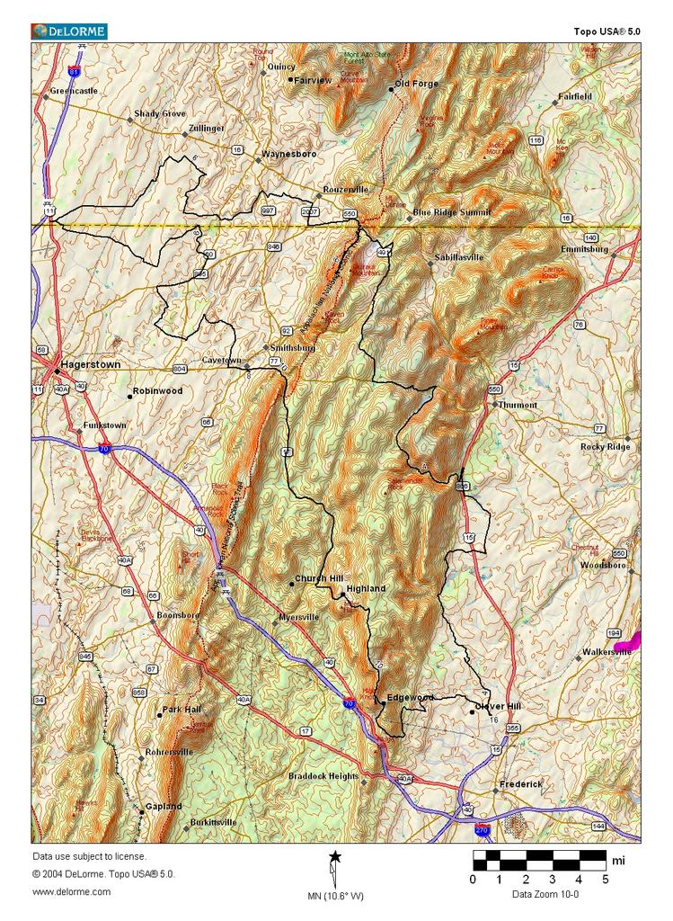
It was a DC Randonneurs' training ride. The "State Line Century". Starting in Frederick, it went up Catoctin Hollow road, and then over the mountain on MD 77. Here's the intersection. This was one of the easier climbs.

Then it was along the mountain to Cascade MD, and a totally gratuitous climb up to High Rock . The plan was to go to the top of Quirauk Mountain, but the nice "US Police" with the assault rifles turned everyone back. There are antennas up there. Some Googling turns up this link, which may suggest what the issue is that requires the presence of assault rifles.
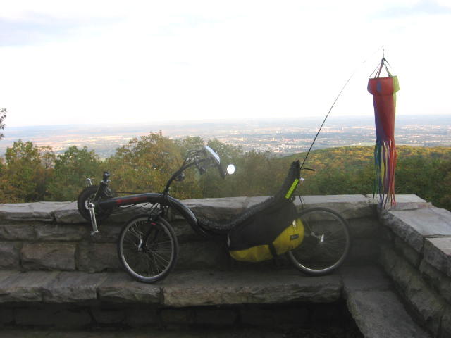
Here is a picture from the top of High Rock, looking north.
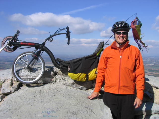
I hauled the bike up to the rock, to discover my camera batteries were dead! That's after a 3 mile climb up a grade of 8-10%! A super nice guy up there enjoying the view with his girlfriend gave me some new batteries and took my picture. I am totally greatful.
Lunch was in State Line, PA, north of Hagerstown, at mile 54. It was pretty easy going to Cavetown, MD, but then there is a big climb over South Mountain. And finally, the crusher, at mile 88, the incredible Crow Rock Road, which has about a half mile that is over 10% with a little bit around 15%, and then another similar stretch on Highland School Road. This puts you on top of the mountain overlooking Frederick.
I was not speedy on this ride. I was under 3 mph up the 15% grades. The whole thing took 8 1/2 hours pedaling, for an average speed of 11.5 mph.
I did get to test out some new gear. I splurged on a new Patagonia Figure 4 soft shell, which was fantastic. The temperature varied from the 40s to about 70, and with all the climbing you sweat a lot and then have the cold wind on the downhill. The new shell, with a Patagonia fleece pullover and base layer underneath, wicked all the sweat away, and I was pretty much warm and dry the whole way.
I've also just bought a GPS Mapping Device. Garmin e-Trex Vista C. It has an altimeter. I figured out how to transfer the track to Delorme TopoUSA, which makes much nicer maps than the Garmin USA Topo map. The GPS thing was dead accurate on time and distance when compared with my trip computer. I think I messed up the altitude calibration when I started, so the climb recorded by the GPS was way off (2000' high) compared with the trip computer, which measured 8100'. Another rider measured 8300'. This was a great ride, fabulous scenery, but good grief that's a lot of climbing. I barely made it in before dark.
1 comment:
What make and model recumbent is that? (Just curious.)
I live near Highland School Road and I can't ride up it (maybe after many more tries).
Post a Comment