A Fleche is a Randonneur event traditionally held on Easter. You make a team and ride a point-to-point route. All the teams for your club meet at a common destination at the end, where everyone collapses and falls asleep. The rules say the route has to be at least 224 miles, and the last 25 km have to be in the last two hours.
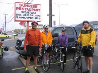
Here is my intrepid team, which is named "Team Torque". That's me, Bill, Lynn, and Jim, from left to right, as we are about to set off at 8:00 am, after a hearty breakfast at the Sunrise Restaurant, in Dewey Beach.
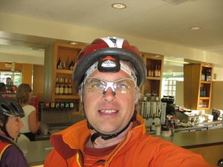
Note how I am wearing a cheap red bike helmet, instead of my usual fancy silver one with abundant ventilation holes and aerodynamic sculpting. That's because I left my bike helmet at home. I had to procure a new one the night before from Wal-Mart. It is very frustrating shopping at Wal-Mart. Wal-Mart is supposed to excel above all other retailers at knowing what their customers want. So I go into Wal-Mart, and in the bike helmet section is a bike helmet with NEON ORANGE FLAMES across the front! RAT FINK! BIG DADDY! YEAH BUDDY! I was so excited!
Well, not so fast. The flames across the front helmets are only available in children's size, years 14 and under. I tried to jam it on my head, but it was just no use. My head is just too fat. Stupid Wal-Mart. If Sam was still alive, there would be helmets with neon flames across the front for everyone. At least the boring helmet I wound up buying only cost $17. It has a helpful sticker inside with a big arrow on it saying "This is the front." I suppose Wal-Mart does still know a little about their customers.
Back to the bike ride. When we set out, there was a headwind, and it started to rain. The rain stopped after an hour or so, and then it cleared up for the rest of the ride. However, the headwind persisted for the next 120 miles, and it blows hard on the Eastern Shore, whcih is flat and often treeless.
Our first control was Nascar Al's, a country store east of Greenville, DE. The sky is clear and the wind is blowing.
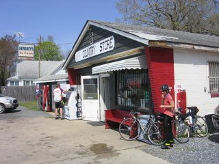
Headwinds are not so bad for me on my recumbent. They took a toll on the rest of Team Torque. Here is a picture from Sudlersville, MD, where they have a monument to Baseball Hall-of-Famer Jimmie Foxx in the town park. I was waiting here for the rest of them to catch up. Jim was back there somewhere fixing a flat tire.

This was about mile 70. Despite the headwinds, we had a 45 minute cusion at that point, but it was down to a 10 minute cushion by the time all repairs were complete and all hydrations were consumed at the Citgo a block over.
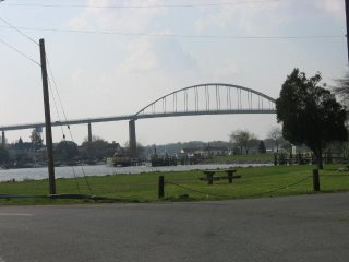
This is the bridge over the Chesapeake and Delaware Canal, in Chesapeake City, MD. Yes, we have to ride over this narrow bridge with no shoulder and flimsy looking guardrail that is very, very high above the water, even though one might think a charming small town like Chesapeake City would have a picturesque low bridge.
We had dinner at the Bohemia Cafe, which was yummy. Here is Team Torque gathering our Iron Will and Nerves of Steel to face the bridge.
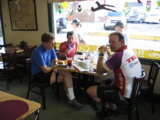
As it turns out, the bridge had no traffic to speak of and was just fine. And we had a lot of fun sharing scary bridge stories. It seems both Lynn and I have ridden into Charleston, SC from the north on US 17, which is about as bad as a bridge can be on a bike.
Soon after this it got dark, and so I stopped taking pictures. Right after Elkton, it gets hilly, and it's pretty strenuous. We had a control in Quarryville, PA, at the Turkey Hill Dairy Store, which was a big hangout for rednecks in pickup trucks.
We rode through Harford County on MD 165, which has a smooth, wide shoulder, and was very smooth going. We stopped for a break in Jarrettsville. I think this was about 2:00 am. This part of the ride is pretty foggy. We realized that we were going to be very hard pressed to make it all the way to Arlington on time. The headwinds and hills in Pennsylvania had taken a toll.
Luckily, Lynn knows all the rules, and she explained that as long as we rode the required 224 miles and had a 22 hour control more than 25 km from the end we would succeed. Our planned route was 240 miles, so it would be possible for us to move the control up to some place past 209 miles, and then ride 16 miles to the first available convenience store. What a lifesaver. We decided to move the 22 hour control from the 7-11 in Calverton, MD to the 7-11 in Annapolis Junction, MD. Our cushion went from -20 minutes to 40 minutes.
After this, we went into Baltimore via Glen Arm and Perring Parkway, which is by far the easiest way into the city from the northeast, in my opinion. It's very scenic too, and a shame we did it at night.
While Jim and I both live in Baltimore, and can deal with inner city neighborhoods, Lynn and Bill had expressed some concern. If you go Hillen Road to Harford to St. Lo Drive to Wolfe St, you are going downhill through all the bad areas. Unless you have some kind of mechanical problem, like when Lynn's headlight bulb burned out at the intersection of Hillen Rd and Harford Rd at 3:00 am on Saturday, and we spent 15 minutes getting it fixed. (She wound up borrowing one of Bill's. Go team.) I didn't think it was an appropriate time for me to explain that the corner of Harford and the Alameda a block down was one of Baltimore's most notorious drug corners, and the big flashing blue light on the phone pole marks the location of a police surveillance camera.
The camera seems to be doing the job. The corner was deserted.
We rode through Fells Point and Little Italy, and stopped for a break at the 7-11 on Light St. in Federal Hill, as deranged homeless madmen pounded on the street signs at the corner of Cross St. By the time everyone was finished with their coffee (Lynn), goo (me) and Cheddarwurst (Jim), we had no more cushion, and I told everyone no more messing around, we have to put the hammer down to get to the 22 hour control by 6:00, and it's not flat either.
Team Torque came through. We hammered up the hills on Annapolis Rd in Westport, and pounded through the nasty littly steep rollers on River Rd. We zipped along the two mile flat stretch of Race Road, and clawed our way out of the Patapsco Drainage Basin between 100 and 175. We plunged past the prisons on Brock Bridge Road to arrive at our 7-11 with 10 minutes to spare. (Jim, amazed, noted we just did 18 miles in 1:45. There is 1200 feet of climb. It's my commute.)
This was mile 213 on my GPS. We had a strategy session to figure out the easiest way to knock off the last 17 miles. We were all pretty spent. Lynn was monosyllabic. Gratuitous hills were out of the question. We decided to do Brock Bridge to Montpelier to Cedarbrook and then Odell Rd. to Edmonson to Sunnyside to Rhode Island Ave. If we could make it to the top of Cedarbrook, it's pretty much all descent from there into the Anacostia watershed.
Which is what we did. We were coasting down Rhode Island Ave, with plenty of time to spare. Where Rhode Island ends in Berwyn Heights, we were still a mile short. We cut over on Paint Branch Parkway to Route 1, and headed south looking for the final control. And there it was, just south of the University of Maryland campus, and right in front of a big hill, the gleaming glass brick and polished metal nirvana, the end of the road, Plato's Diner. With a sausage and cheese omelet for Bill and a big piece of pie for me.
Here we are, after conquering the Fleche.
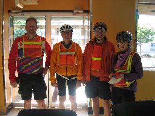
Lynn totally saved our butts. If she hadn't explained how we could adjust the 22 hour control, we would have rolled into Arlington 30 minutes late with 16 unneeded miles.
Here's the map, with the GPS track for the route as ridden.
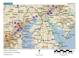
I've also uploaded the recorded GPS information to MotionBased, the link is here. You may need to register, I haven't tried linking to them before.
No comments:
Post a Comment